
Estimating Travel Time for Boat Journeys
To calculate boat travel time, divide your planned route distance in nautical miles by your expected speed in knots, then add time for slow sections, stops, and delays. The arithmetic gives you a starting point; a useful arrival estimate also needs a checked route and realistic assumptions. This article explains how to turn distance figures into a practical schedule without treating a calculator’s answer as a guarantee.
You can get a first port-to-port distance and ETA with SeaETA, then refine the schedule with the checks below.
How do you calculate boat travel time?
Boat travel time in hours equals distance in nautical miles divided by speed in knots. One knot means one nautical mile per hour, so these units work together directly. For example, a hypothetical 48-nautical-mile passage at a steady 12 knots takes four hours before stops or delays. (oceanservice.noaa.gov)
Travel time in hours = route distance in nautical miles ÷ average speed in knots
Keep the units consistent. A nautical mile equals 1.852 kilometers, or approximately 1.15 statute miles; entering ordinary miles while keeping speed in knots produces the wrong result. Check the distance and speed settings before copying figures between devices. (oceanservice.noaa.gov)
Decimal hours also need converting. Multiply the fractional part by 60: 3.5 hours means three hours and 30 minutes, while 3.2 hours means three hours and 12 minutes. Do not read the digits after the decimal point as minutes. (uscgaux-ocnj.org)
Keep your first result labeled underway time, not total journey time. That distinction makes it easier to add harbor maneuvering, waiting, and planned breaks without losing track of what the calculation includes.
Start with the route you can actually navigate
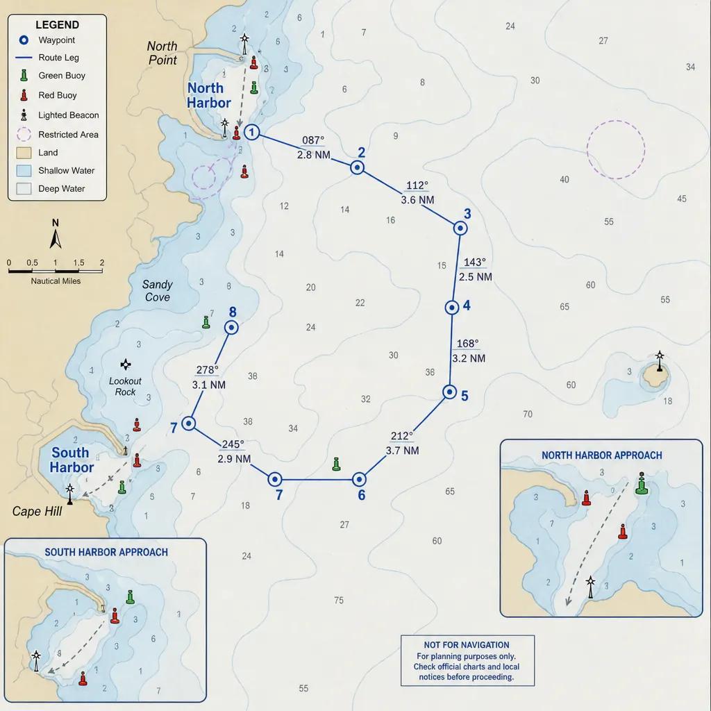
Before measuring port to port distance, define the actual departure and arrival points. For your own plan, specify whether each endpoint is a marina berth, harbor entrance, anchorage, or offshore waypoint. Otherwise, you could leave the approach miles out of the calculation.
Next, check the route against current official nautical charts and relevant local navigation information. NOAA charts provide information about depths and underwater hazards, while the U.S. Coast Pilot supplies additional coastal navigation detail that is difficult to show on a chart. A line connecting two ports is not, by itself, a checked passage plan. (oceanservice.noaa.gov)
When comparing nautical distances between ports, use this review checklist:
- Match the endpoints: Include the distance from your departure berth to the start of the main passage, plus the destination approach.
- Inspect the full track: Check that every leg follows an appropriate navigable route rather than simply connecting place names.
- Record route choices: Note any planned detour or alternative so its distance is included deliberately.
- Keep the units visible: Label distances as nautical miles throughout your notes.
Treat the sea distance between ports by boat as a route-specific measurement. Save the waypoints alongside the total so you can explain, check, and revise that figure later.
Choose a realistic planning speed
For estimating progress along a geographic route, use expected speed over ground rather than assuming speed through the water will be identical. Speed over ground describes movement relative to the Earth; speed through the water describes movement relative to the surrounding water. Current can make those readings differ. (humminbird-help.johnsonoutdoors.com)
Start with your own records from comparable trips, if available. Choose a sustainable planning speed rather than your boat’s highest observed reading. Write down the conditions behind that assumption so you can judge whether it still fits the intended passage.
Avoid applying one cruising speed to every mile. Instead, give departure channels, open-water legs, and destination approaches separate speed assumptions. This makes the estimate easier to adjust when only one part of the journey changes.
For a first planning attempt, calculate two versions: one using your expected speed and another using a lower speed. The slower case is not a prediction of bad weather. It is a way to test how much flexibility your schedule has.
What can change your arrival estimate?
Currents, changing marine weather, route revisions, and time spent waiting can all require you to revise an arrival estimate. Check marine forecasts and local tide and current information before departure rather than assuming the outward and return passages will take the same time. NOAA provides separate predictions for water levels and tidal currents because they describe different conditions relevant to navigation. (marinenavigation.noaa.gov)
Current and tidal timing
Use tidal current predictions for the relevant location and passage time, not water-level predictions alone. NOAA current predictions identify expected maximum flood and ebb currents and the timing of slack water. Tide predictions instead help identify the timing of high and low water. (marinenavigation.noaa.gov)
Recheck your timing assumptions if departure changes. Keep any planned wait for suitable conditions separate from the time spent moving. That way, you can see whether changing departure would alter the schedule, rather than merely shifting the same estimate later.
Weather and planned delays
Review a marine forecast covering the route and expected travel period, including wind, waves, visibility concerns, and warnings. The National Weather Service emphasizes that marine conditions can change suddenly and that forecast ranges do not describe every location or moment equally. (weather.gov)
List planned stops and possible waiting points explicitly. A fuel stop, meal break, or scheduled opening should have its own allowance rather than being hidden inside an optimistic average speed. Confirm any time-sensitive local arrangements with the responsible operator before relying on them.
Build a leg-by-leg journey estimate
A leg table keeps the calculation transparent. The following fictional journey illustrates the method; its distances and speeds are assumptions, not guidance for any particular boat or location.
| Journey leg | Distance | Assumed average speed | Calculated time |
|---|---|---|---|
| Departure channel | 3 nautical miles | 6 knots | 30 minutes |
| Main passage | 36 nautical miles | 12 knots | 3 hours |
| Destination approach | 6 nautical miles | 6 knots | 1 hour |
| Total underway | 45 nautical miles | — | 4 hours 30 minutes |
Suppose you then allow 30 minutes for a planned stop. Your scheduled journey becomes five hours before any contingency allowance. With an 08:00 departure, that produces a baseline arrival of 13:00.
Now test a slower main passage. At nine knots, the 36-nautical-mile middle leg takes four hours instead of three. Everything else unchanged, the journey becomes six hours including the stop, moving the baseline arrival to 14:00.
This comparison gives you a more useful planning range than a single precise-looking number. Record the assumptions beside each result and choose any additional contingency deliberately. Do not describe either baseline as a guaranteed arrival time.
How should you use a port distance calculator?
Use a port distance calculator to support route measurement, then verify its endpoints, units, track, and assumptions before using the result in your schedule. A boat journey planner is most useful when you can inspect and revise the information behind its answer. Official charts and navigation publications remain essential checks on the intended route. (oceanservice.noaa.gov)
Before accepting a result, work through these steps:
- Confirm both locations. Check that similarly named ports or nearby terminals have not been selected accidentally.
- Inspect the plotted route. Do not rely on the distance total without reviewing where the track goes.
- Check nautical miles between ports. Verify that the displayed unit matches the knots used in your calculation.
- Review the speed input. Identify whether the estimate uses your chosen average or an unchanged default.
- Add missing time. Include approaches, stops, and waiting only once, avoiding both omissions and double counting.
Save a simple written version of the calculation. Keeping the route legs, speed assumptions, and allowances together makes the estimate easier to review before departure and update underway.
Try it on SeaETA: enter two ports in the port distance calculator, set your planning speed in knots, and use the result as underway time — then add approaches, stops, and contingency as described above. Estimates are for planning only, not navigation.
Keep the schedule flexible
Before leaving, compare your expected arrival with a slower scenario and identify a suitable alternative plan. Check the latest marine forecast again rather than relying solely on an earlier outlook. The National Weather Service recommends obtaining current forecast and warning information before setting out. (weather.gov)
As you compare actual progress with your planned legs, revise the remaining distance and speed assumptions instead of preserving the original arrival on paper. Keep fuel planning separate from the timetable: the Coast Guard recommends the one-third fuel rule for an out-and-back trip—one-third outward, one-third returning, and one-third in reserve. (uscg.mil)
The best estimate is not the most precise-looking answer. It is a checked route, a realistic speed assumption, and a schedule you are prepared to change.